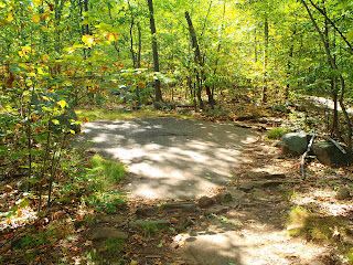
For me, nature has always acted as a respite. Even when I was little and I'd get in a fight with my mom or my brother or sister I would run off into the woods behind our house and disappear for however long was necessary. As I've grown this need, this desire really, has only grown with me. So it makes perfect sense that now, a newly unemployed me (after 9 years of employment), would want nothing more then to venture into the woods and never come out. What better, really, then to do so (if you are an adult, and a logical one at that, this is the point where you should be thinking that applying for jobs and bulking up my resume would be a much better, and more mature, idea-and to you I say, blah!). So again, I set off into the woods on Thursday to disappear for just a little while. This time around it was Harriman State Park/Bear Mountain. I parked at the Anothony Wayne Recreation Area right off of the Palisades Interstate Parkway. A very conveniently located and easy to find parking lot. While I sat in my car trying to figure out some sort of poorly pieced together loop hike, as I always do (so prepared), a man came up to my window and asked where he should start. I gave him a few options: White to Blue, White to Fawn, just White-and wished him the best. When I finally made my way out of my car he was still there with his daughter, who I'm guessing was about five, and he asked if I'd like to hike with them. I made up some excuse about not yet knowing which trails I was going on and he said "It's always nice to hike with company", which, I must say, I vehemently disagree with...not to mention that in that one sentence he discounted his poor daughter as company i.e. a person. At this point I took matters into my own hands and told him, kindly, that I prefer hiking alone. Out there alone in the woods all I need is the sound of nature, my footsteps, and my heavy breathing (plus some iPod action never hurt). He went off on his way and I set off on mine. I began by crossing the street on which you drive into the recreation area and setting forth on the bike trail (note: I went the complete opposite way of the man I had talked to. I never claimed to be a social being) which quickly leads to the white trail. When I came to an intersection, which consisted of the White trail, Beechy Bottom Road (a mountain bike trail/woods road), and the Fawn trail, I naturally chose the Fawn trail (as any right minded animal lover would). While traveling on this trail, which is marked with white squares with a red 'F' on them (because it's part of the Red trail), I discovered that it was improperly named and should really be renamed as the Fern trail. There were ferns in every direction!

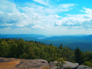
I quickly turned off the Fawn trail onto the Blue trail to begin my poorly mapped out loop hike. On the trail map (map 119 of the NewYork-New Jersey trail conference) this trail is marked with two stars representing two scenic views. They certainly do deliver, and I'd even argue that there are many more then just those two, but perhaps as an outdoors lover I'm a bit biased. At one point I reached a particularly beautiful spot, in my opinion (I can't give you anyone else's), and I'm standing at the top of the mountain with my iPod blasting shaking my head at just how spectacular it all is only to turn around and see that my friend from the parking lot and his daughter are sitting behind me in the shade enjoying nice juicy, refreshing clementines. I said hi, probably louder then anyone ever should due to my headphones being jammed in my ears and my music blaring, and quickly hurried away, a bit embarrassed for having been caught in my private moment of appreciation for nature and all the pure goodness it is able to supply a nobody like me.

The Blue trail transitions into the Blue and White trail so I was able to continue on my way on West Mountain. I had originally been planning on turning left onto the Yellow trail and going all the way up that until it meets with the White trail, but when I looked at my map more diligently I noticed that if I stayed on the Blue trail I would be blessed with experiencing one of Harriman's lean-tos. As someone who has backpacked Harriman, and seen four of the parks wonderful lean-tos (some more wonderful then the others) I decided this was something I was interested in. So instead of turning onto the Yellow trail I continued on the Blue trail (which is to the left when the Blue and White trails split) and continued on to West Mountain Shelter. On my way to the shelter I came across a deer who was munching on some plants directly on the trail. When she saw me she began following the trail so it was as if we were hiking together. Not so far down the trail she turned off to drink some lovely, and very refreshing, swamp water. Now, about the West Mountain Shelter, all I have to say is I love how many people don't know, or care to find, these gems hidden in the woods. West Mountain Shelter has a view that many people would pay good money for, and here it is in the woods...for free. Seeing as I was hiking on a 90 degree I decided to turn off my hiking GPS and take a short break in the shade of this great place!


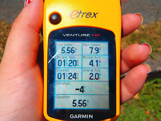
It was soon after enjoying this short break at the shelter I realized that this hike may not have been the best plan on this particular day. It was hot out and I had some place I needed to be at 5. I continued following the Blue trail until I reached the Red Trail (Red cross) which I knew I needed to make a left on to complete the loop as originally planned), but I was feeling all sorts of backwards and even after making the turn, and religiously checking my trail GPS to make sure that the shape that was being recorded resembled the loop I was going for, I was starting to get nervous. I had to scale some rocks, which normally I would find totally enjoyable, but at this particular time on this particular day I was sure I was going to die. My calves started aching and the water from my water pack has never taste better as I continued on my trek. I got confused (I never claimed to be an expert) when I came across an intersection between the Blue and Red trail, because I thought I was further along the trail then where the map showed they crossed, but I successfully carried on. Then I came to a four way intersection: behind me was the red trail, in front of me was the red trail, to the right was the red trail, and to the left was the red trail. My sense of direction, at this point at least, was still pretty good so I knew I just had to turn left and follow wherever the trail lead me. To the left was the 1777 trail which, had I read the back of the map before I was on it seeing all these historical plaques, I would have known was one of the Revolutionary Trails retracing the steps of the British and American troops during the Revolutionary War. 1777 was a very cool, easy, and educational trail.

As I'm happily continuing on the 1777 I come up to a post that looks like it should have a sign on it, but, just my luck, instead it has a note which reads "Vandals have removed the 'you are here' map" and then explains which way to go at the intersection I'm standing at, which would be great except, of course, Anthony Wayne Recreation Area isn't listed on this note! So, using my map and trying to figure out the fastest and shortest way to race back to my car (at this point it's 4 and once I get to my car I'm still a half hour from home and, oh yea, I need to be somewhere in an hour!) and choose the Doodletown Bridle Path that is to my left. Doodletown, interestingly enough, was the site of a quaint little hamlet back in 1762, and while it's popularity increased over the next two hundred years, by 1965 the state had bought all the houses and let nature take its course...or something like that. Of course the Doodletown Bridle Path has no markers and I start coming across what looks like trails, but when I turn onto them and find that they too have no markers I get nervous and become totally lost and backwards and try heading back in the direction I had come from. Eventually I find Brown markers...only there's no Brown trail and as I continue on this steep rock climbing trail I study the markers more and more and realize that, perhaps, they're not Brown markers at all, but instead Brown spray paint used to cover up White markers because trails do get switched and rerouted! I've scaled too many rocks to climb down though and decide that I'm just going to keep pushing. It's around this time that I decide if I come to the top of the mountain and am able to see my car at the bottom of the cliff I am going to somehow figure out a way to successfully climb/ricochet/jump off to get to the parking lot and FINALLY get home (thoughts like this may be why both my mother and boyfriend worry about me hiking alone, however, in my defense, I make paracord bracelets and I just happened to be wearing a cobra stitch one. That gave me at least 8 feet of cord to work with so my plan was, if you think about it, totally logical!). I never do get to the top of the mountain, and my camera dies, but I keep trucking on and eventually I stumble upon the White trail ::deep sigh of relief:: and from that point all I had to do was retrace my steps back down the fawn trail and right on over to the parking lot. So the hike, which I had thought would take be 3 hours or so, ended up taking me five hours and I was a half hour late for what I needed to do, but didn't someone important once say "It's the journey that matters, not the destination" or some sort of rambling like that...which was obviously said by someone who never got lost in the woods in 90 degree heat. In all reality though two of my favorite quotes are "Lost in the woods with no need to be rescued" (seen on a shirt at Kittatinny Campgrounds in Barryville, NY...which everyone should go to...only not when I'm there) and "Do not go where the path may lead, go instead where there is no path and leave a trail" said by the great Ralph Waldo Emerson.

Zen


