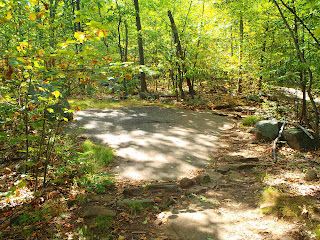
After signing the guest book we headed up the mountain. Hadley Mountain is 2,654 feet and during the hike itself you gain 1,525 feet of elevation (I'm going off memory with these numbers from an article in Adirondack Life on the fire tower challenge-which is climbing 18 of the 23 mountains with fire towers on them in the Adirondacks. Anyway, numbers may not be 100% spot on). I can tell you now, however, that being a Bergen County girl who hikes Harriman, Bear Mountain, Storm King, Ramapo, and the Palisades that we don't have hikes like this around here. At least I've never done any. It's a short hike, two miles up and two miles down (since it's all one trail), but it's steep. Also, the mountain had three significant fires in the early 1900s that it's still recovering from so there are a number points on the trail in which you are walking directly on the rock of the mountain. The soil was compromised from fires and never recovered in these sections.
I won't even try to fake that the incline didn't kick our butts. We were definitely huffing and puffing our way up this mountain. We passed a family that was on their way down and asked how much longer to the top and the wife said 30 minutes and we must have exhaled hard or something to show the exhaustion that we were experience and her husband said "Yea I know. The first section is really hard right? It just brings you straight up". I grasped onto what he said because that meant that there was a second section that wasn't so hard! We did eventually reach the second section which flattens out a bit and offers some beautiful views.
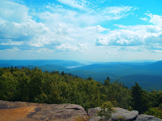
The next person we talked to was our guardian angel. This gorgeous little cherub looking blonde little girl who said "You're almost there!" when we passed her. Our savior! As we continued climbing I realized, however, that children have no perception of time or distance. Finally, we got to the top. Before you get to the summit there is a house to the right that was the ranger house back when the fire tower was first opened. The house stopped being used in 1990 and then was reopened in 1996 and is staffed in the summers, though no one was there when we were snooping around outside of it. The fire tower is sturdy and can be climbed, however, you don't have to climb it to get great views. From the summit it's just a 360 of a gorgeous mountain range, endless sky, and the Great Sacandaga Lake.
From the summit there is a little trail that leads to a small open area with a few small cairns (which the children we passed were calling rock animals) and a fire pit made of rocks. My friend relaxed on the summit while I wandered on that trail. On my way back to the summit there was a rock step that had a piece of bark under it, which looked out of place to me. I pulled the bark away and, low and behold, I had found a geocache! Never before have I found one without coordinates, and I've definitely never found one when not even looking for one. I was so psyched! I ran back to the summit of the mountain, almost knocked two people over even, and screamed "Guess what I found? Guess what I found?" to my friend that was maxing relaxing Huckleberry Finn style. He replied "Who died?" and I grabbed my hiking pack and said "A Geocache! Come with me!". As it turns out, he didn't even know what a geocache was so double fun there.
I was SO excited about this cache that I even spelt my geocaching name wrong. Shrugs! I definitely am going to do this hike again. The views are just too beautiful and I want to share them with just about anyone that is willing to take the trek. Next time, I'm definitely going to look at geocaching.com so I can find all the caches hidden amongst the mountains!


No comments:
Post a Comment